GeoGraph : Modelling and building a graph database of multi-source landmarks to help emergency mountain rescuers
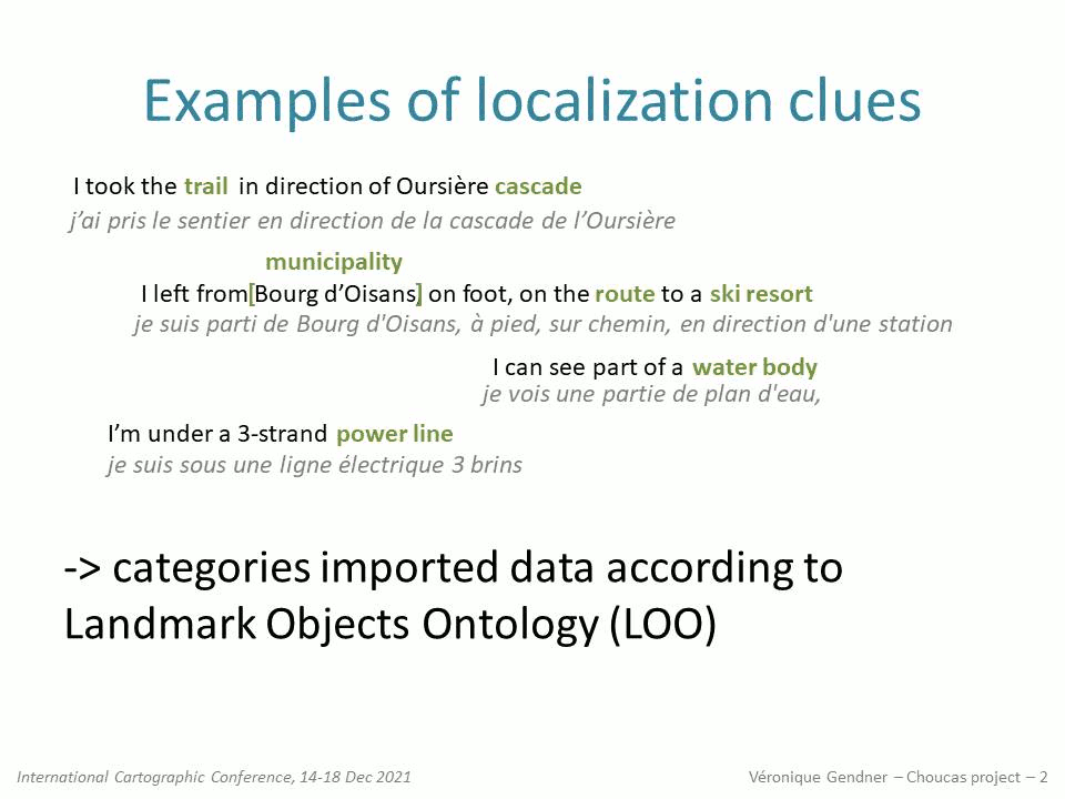
The purpose of the Choucas research project is to come up with methods, tools and resources, to help mountain rescue team localise victims, when answering emergency calls. In this context, we have built a graph data base with the Neo4j Label Property Graph (LPG) technology, that integrates several sources of geolocated objects. Some data comes from the national mapping agency (IGN BDTOPO), others, like routes from crowdsourcing websites. Categorization of multi-source imported data has been normalized by an instantiation process based on the Landmarks Objects Ontology (OOR) that had previously been produced by the project team.
The flexibility of graph databases helps make the right modelling choices by progressively taking into account problems observed in the data as well as researchers and users feedback and new needs.
A more in depth presentation of this work, with a demo of a python script to display the content of the database on a map, with QGIS can be seen here.
Here is the presentation of this work done at the International Cartographic Conference, on 15th Dec. 2021 :
 alerte email - nouveaux articles
 fil RSS - nouveaux articles
 Véronique Gendner, e-tissage.net